Azimuthal Map Server
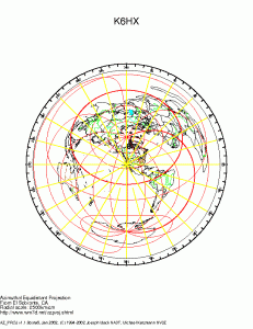
An azimuthal map shows the compass direction for the shortest path to a given location from the place the map is centered. This can be useful to help you aim antennas. I’ve used GMT to make maps before, but if you need a custom azimuthal map for your location, try surfing over to NA3T and NV3Z’s website, and make yourself one.
Here is the low resolution GIF image of mine, I downloaded a PDF that I printed on our ncie color printer.
You can see that Australia is mostly just south of west, Japan is northwest, and most of Europe is northeast. Interestingly, the tip of Africa is almost straight west, as is the panhandle of Florida.

I recall burning three or four weeks of a sabbatical getting Saccade.com on the air with Wordpress. So much tweaking…