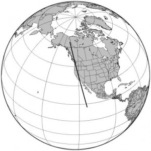
Ground tracks of satellite passes…
Every once in a while, I feel like making high quality pictures of ground tracks of satellites. The Generic Mapping Toolkit is handy, especially when combined with the pyephem library.
The thick line is the ground track of the amateur satellite AO-51, at any point in its next pass where it is visible from my home location. My idea is to script this up into a generic satellite prediction utility that I can access from my webpage. Stay tuned.
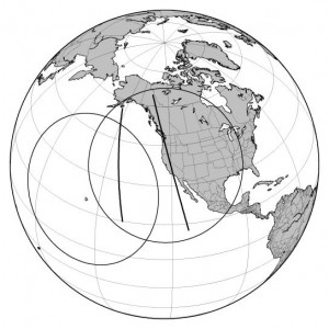
Addendum: I’m particularly interested in passes which might allow me to communicate with Hawaii. Here is a similar map, showing two passes of AO-51 (both passes start from south and move north) and also show the footprints of both San Francisco and Honolulu Hawaii. Any portion of the satellite path which is common to both circles should allow a CA-HI QSO to occur.


I recall burning three or four weeks of a sabbatical getting Saccade.com on the air with Wordpress. So much tweaking…